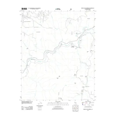
2012 Map of Miracle Hot Springs
USGS Topo · Published 2012About this map
Miracle Hot Springs and the historic settlement of Havilah anchor this study of the Southern Sierra Nevada landscape. The Kern River carves a deep path through the center of the sheet, supporting industrial and recreational sites like the Borel Powerhouse, Hobo Campground, and Davis Campground. The map reveals a transition from the river valley to high peaks, including Rough and Ready Mountain, Lightner Peak, and Quartz Mountain. Local ranching and early commerce are evidenced by Goff Ranch and its proximity to Golf Meadow. A network of Forest Service routes, such as Forest Rte 26S06 and Kern Canyon Rd, connects these remote locales. Geothermal features like Delonegha Hot Springs and the enigmatic Peterson Landmark Object highlight the unique geological and cultural markers of this Kern County region.
Find a feature on this map
70 named features on this map. Tap any name to fly to it.
Don’t see what you’re looking for? This feature index may not catch every label — zoom into the map to look around manually.
Map Details
Editions of this 2012 Miracle Hot Springs Map
This is the sole edition of this map. No revisions or reprints were ever made.
Other maps of this area

1906 · Kernville
USGS Topo · 1:125,000

1908 · Kernville
USGS Topo · 1:125,000

1914 · Caliente
USGS Topo · 1:125,000

1915 · Mojave
USGS Topo · 1:125,000

1920 · Delonagha
USGS Topo · 1:62,500

1926 · Glennville
USGS Topo · 1:62,500

1936 · Tobias Peak
USGS Topo · 1:125,000

1943 · Emerald Mtn
USGS Topo · 1:62,500

1943 · Breckenridge Mountain
USGS Topo · 1:62,500

1943 · Tobias Peak
USGS Topo · 1:125,000