1970 Map of Miramar Beach
USGS Topo · Published 1977About this map
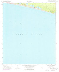
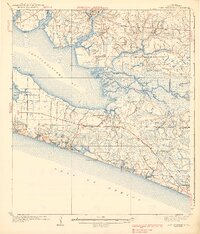
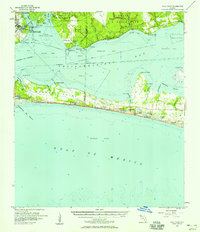
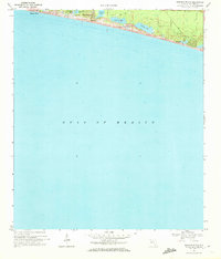
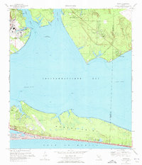
Miramar Beach and the neighboring shoreline of the Gulf of Mexico are depicted here during a period of coastal growth in the late 1960s and mid-1970s. This survey illustrates a landscape of coastal dune lakes, a rare geological feature where freshwater bodies like Morris Lake, Campbell Lake, and Stalworth Lake sit in close proximity to the saltwater gulf, separated only by a narrow band of sand dunes. These lakes are significant for local history and environmental studies, as they represent a unique hydrological system characteristic of this specific stretch of the Florida Panhandle.
Find a feature on this map
16 named features on this map. Tap any name to fly to it.
Don’t see what you’re looking for? This feature index may not catch every label — zoom into the map to look around manually.
Map Details
Editions of this 1970 Miramar Beach Map
2 editions found
Other maps of this area

1935 · Villa Tasso
USGS Topo · 1:48,000

1936 · Point Washington
USGS Topo · 1:48,000

1938 · Villa Tasso
USGS Topo · 1:62,500
1939 · Point Washington
USGS Topo · 1:62,500
1956 · Villa Tasso
USGS Topo · 1:62,500

1957 · Pensacola
USGS Topo · 1:250,000

1959 · Pensacola
USGS Topo · 1:250,000

1960 · Pensacola
USGS Topo · 1:250,000
1970 · Miramar Beach
USGS Topo · 1:24,000
1970 · Destin
USGS Topo · 1:24,000