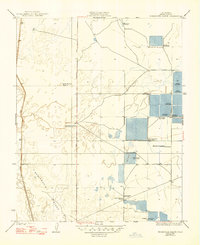
1930 Map of Miramonte Ranch
USGS Topo · Published 1947About this map
Semitropic Ridge and the Lost Hills define this Kern County landscape as it appeared in the late 1920s. This survey reveals a terrain dominated by an extensive network of specialized hunting clubs, reflecting the regional importance of seasonal waterfowl habitat. Landmarks such as the General Petroleum Gun Club, Sierra Gun Club, and El Cinco Gun Club occupy large, gridded sections of the valley floor.
Find a feature on this map
25 named features on this map. Tap any name to fly to it.
Don’t see what you’re looking for? This feature index may not catch every label — zoom into the map to look around manually.
Map Details
Editions of this 1930 Miramonte Ranch Map
2 editions found
Other maps of this area

1914 · Lost Hills
USGS Topo · 1:125,000

1927 · Semitropic
USGS Topo · 1:31,680

1929 · Hacienda Ranch
USGS Topo · 1:31,680

1929 · Allensworth
USGS Topo · 1:31,680

1930 · Leonards
USGS Topo · 1:31,680

1930 · Hamlin School
USGS Topo · 1:31,680

1930 · Miramonte Ranch
USGS Topo · 1:31,680

1931 · Goose Lake
USGS Topo · 1:31,680

1932 · West of Goose Lake
USGS Topo · 1:31,680

1932 · Reynolds Ranch
USGS Topo · 1:31,680