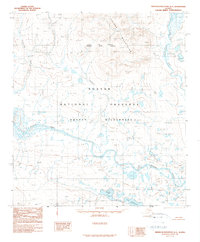
1990 Map of Misheguk Mountain A-1
USGS Topo · Published 1990About this map
Noatak National Preserve and the Noatak Wilderness dominate this Arctic landscape, capturing a vast protected corridor in the late twentieth century. The serpentine path of the Noatak River cuts through the center of the sheet, joined by tributaries like the Anisak River and Itimtikrak Creek. This survey reflects a time of finalized federal land management in Alaska, following the establishment of these protected areas. The Igivruk Mountains rise to the north, while the southern reaches are dotted with remote water bodies such as Okoklik Lake and Lake Kangilipak. The map documents a terrain devoid of roads, defined instead by the natural drainage patterns of New Cottonwood Creek and the high elevation contours that separate the Northwest Arctic Borough from the North Slope Borough.
Find a feature on this map
10 named features on this map. Tap any name to fly to it.
Don’t see what you’re looking for? This feature index may not catch every label — zoom into the map to look around manually.
Map Details
Editions of this 1990 Misheguk Mountain A-1 Map
This is the sole edition of this map. No revisions or reprints were ever made.
Other maps of this area

1951 · Baird Mountains
USGS Topo · 1:250,000

1951 · Howard Pass
USGS Topo · 1:250,000

1951 · Ambler River
USGS Topo · 1:250,000

1951 · Misheguk Mountain
USGS Topo · 1:250,000

1956 · Howard Pass
USGS Topo · 1:250,000

1956 · Ambler River
USGS Topo · 1:250,000

1956 · Misheguk Mountain
USGS Topo · 1:250,000

1956 · Baird Mountains
USGS Topo · 1:250,000

1964 · Ambler River
USGS Topo · 1:250,000

1965 · Baird Mountains
USGS Topo · 1:250,000