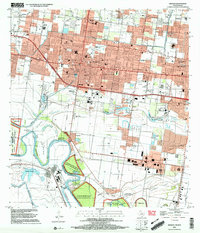
2002 Map of Mission
USGS Topo · Published 2003About this map
Mission and Mcallen anchor this detailed landscape where urban expansion meets the agricultural and natural corridors of the borderlands. The southern boundary is defined by the winding course of the Rio Grande, or Rio Bravo, where international water rights and historical land partitions are visible in named tracts like Anzalduas Banco No 45 and Granjeno Banco No 44. This area is a critical ecological zone, preserved through the Lower Rio Grande Valley National Wildlife Refuge, which provides a buffer between the densely packed residential areas of Mission and the riverbanks.
Find a feature on this map
69 named features on this map. Tap any name to fly to it.
Don’t see what you’re looking for? This feature index may not catch every label — zoom into the map to look around manually.
Map Details
Editions of this 2002 Mission Map
This is the sole edition of this map. No revisions or reprints were ever made.
Other maps of this area

1914 · San Juan
USGS Topo · 1:48,000

1916 · San Juan
USGS Topo · 1:62,500

1940 · Monte Christo
USGS Topo · 1:62,500

1949 · Mc Allen
USGS Topo · 1:250,000

1954 · McAllen
USGS Topo · 1:250,000

1957 · Mc Allen
USGS Topo · 1:250,000

1962 · McAllen
USGS Topo · 1:250,000
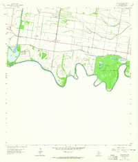
1962 · Las Milpas
USGS Topo · 1:24,000

1963 · La Joya
USGS Topo · 1:24,000

1963 · Edinburg
USGS Topo · 1:24,000