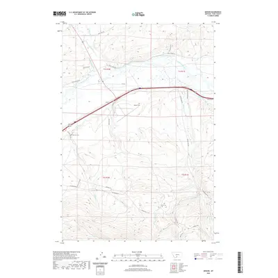
2020 Map of Mission
USGS Topo · Published 2020About this map
The confluence of the Shields River and the Yellowstone River anchors this Park County landscape, where water management has long dictated the layout of the land. A complex system of irrigation, including the Middle-Windsor Ditch, Upper Windsor Ditch, and Vallis Ditch, illustrates the agricultural engineering required to sustain the valley. The small settlement of Mission sits near Mission Field, surrounded by a network of ranch roads and historic paths like the Horse Thief Trl. Genealogy researchers will find several notable landmarks, such as the Poor Farm Cem and Bruffey Cem, reflecting the early community's history. The terrain transitions from river bottoms to higher elevations marked by Poison Cr and Mission Cr, with travel routes like Convict Grade Rd and Old Boulder Rd following the natural contours of the Montana countryside.
Find a feature on this map
36 named features on this map. Tap any name to fly to it.
Don’t see what you’re looking for? This feature index may not catch every label — zoom into the map to look around manually.
Map Details
Editions of this 2020 Mission Map
This is the sole edition of this map. No revisions or reprints were ever made.
Other maps of this area

1891 · Livingston
USGS Topo · 1:250,000

1893 · Livingston
USGS Topo · 1:250,000

1947 · Bozeman
USGS Topo · 1:250,000

1948 · Bozeman
USGS Topo · 1:250,000

1951 · Mount Rae
USGS Topo · 1:24,000

1951 · Chadborn
USGS Topo · 1:24,000

1951 · Grannis
USGS Topo · 1:24,000

1951 · Brisbin
USGS Topo · 1:24,000

1951 · Livingston Peak
USGS Topo · 1:24,000

1951 · Hunters Hot Springs
USGS Topo · 1:24,000