
1951 Map of Grannis
USGS Topo · Published 1953About this map
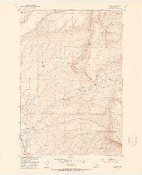
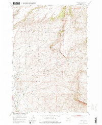
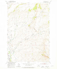
The Shields River valley defines this mid-century landscape in Park County, where the Northern Pacific railroad follows the riverbank near the settlement of Grannis. This era is characterized by a sparse but established ranching economy, with family-named operations such as the Eyman Ranch, Hetzel Ranch, and Bohleen Ranch scattered across the drainage basins of Falls Creek and Adair Creek. The distribution of local infrastructure, including the Falls Creek School and Grannis School, reflects the decentralized nature of rural life in this part of Montana during the early 1950s.
Find a feature on this map
22 named features on this map. Tap any name to fly to it.
Don’t see what you’re looking for? This feature index may not catch every label — zoom into the map to look around manually.
Map Details
Editions of this 1951 Grannis Map
4 editions found
Other maps of this area

1891 · Livingston
USGS Topo · 1:250,000

1893 · Livingston
USGS Topo · 1:250,000

1947 · Bozeman
USGS Topo · 1:250,000

1948 · Bozeman
USGS Topo · 1:250,000

1951 · Ibex Mountain
USGS Topo · 1:24,000

1951 · Clyde Park
USGS Topo · 1:24,000

1951 · Chadborn
USGS Topo · 1:24,000

1951 · Hunters Hot Springs
USGS Topo · 1:24,000

1951 · Elton
USGS Topo · 1:24,000
1951 · Fairview Peak
USGS Topo · 1:24,000