
1951 Map of Clyde Park
USGS Topo · Published 1953About this map
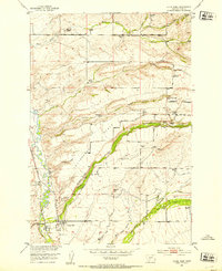
Clyde Park serves as the primary hub for this Park County landscape, situated along the Northern Pacific railroad and the Shields River. The settlement's connection to the regional rail network is anchored by the Clyde Park Sta, while the surrounding geography is defined by the prominent Cottonwood Bench and numerous family-held ranch lands. The pattern of 1950s rural life is visible through the placement of the Sumner School and several community landmarks including the Mt Calvary Cem and Rock Creek Cemetery. High-elevation landmarks like Squaws Tit overlook a series of drainages, including Cottonwood Creek and Indian Creek, which support a network of ranching operations such as the Thompson Ranch, Lovely Ranch, and Kensfather Ranch. This survey captures the transition from the river valley to the higher benches during a period when small-scale family agriculture was the bedrock of the local economy.
Find a feature on this map
45 named features on this map. Tap any name to fly to it.
Don’t see what you’re looking for? This feature index may not catch every label — zoom into the map to look around manually.
Map Details
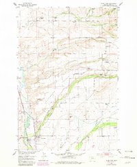
Editions of this 1951 Clyde Park Map
3 editions found
Other maps of this area

1886 · Little Belt Mts.
USGS Topo · 1:250,000

1891 · Livingston
USGS Topo · 1:250,000

1893 · Livingston
USGS Topo · 1:250,000

1894 · Little Belt Mts.
USGS Topo · 1:250,000

1897 · Little Belt Mts.
USGS Topo · 1:250,000

1898 · Little Belt Mts.
USGS Topo · 1:250,000

1902 · Little Belt Mts.
USGS Topo · 1:250,000

1947 · Bozeman
USGS Topo · 1:250,000

1948 · Bozeman
USGS Topo · 1:250,000

1948 · White Sulphur Springs
USGS Topo · 1:250,000