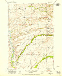
1951 Map of Clyde Park
USGS Topo · Published 1953About this map
The Shields River valley defines this mid-century landscape, where the Northern Pacific railroad facilitates the ranching and agricultural life of Park County. The town of Clyde Park serves as the regional hub, anchored by the Clyde Park Sta and the nearby Mt Calvary Ch. Rising above the river bottom, the distinct plateau of Cottonwood Bench overlooks a network of family-held lands including the Lee Ranch and Fisher Ranch.
Find a feature on this map
45 named features on this map. Tap any name to fly to it.
Don’t see what you’re looking for? This feature index may not catch every label — zoom into the map to look around manually.
Map Details
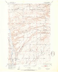
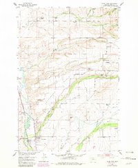
Editions of this 1951 Clyde Park Map
3 editions found
Other maps of this area

1886 · Little Belt Mts.
USGS Topo · 1:250,000

1891 · Livingston
USGS Topo · 1:250,000

1893 · Livingston
USGS Topo · 1:250,000

1894 · Little Belt Mts.
USGS Topo · 1:250,000

1897 · Little Belt Mts.
USGS Topo · 1:250,000

1898 · Little Belt Mts.
USGS Topo · 1:250,000

1902 · Little Belt Mts.
USGS Topo · 1:250,000

1947 · Bozeman
USGS Topo · 1:250,000

1948 · Bozeman
USGS Topo · 1:250,000

1948 · White Sulphur Springs
USGS Topo · 1:250,000