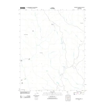
2012 Map of Mississippi Creek
USGS Topo · Published 2012About this map
Bear Mountain stands as a central peak in this landscape, serving as a primary drainage divide for the numerous seasonal and perennial waterways that define the region's geography. Water sources like Bear Springs and Board Springs are critical landmarks in this arid environment, feeding into the complex networks of Mississippi Cr and the N Fork Pacheco Cr. The terrain is characterized by prominent ridges such as Rock House Ridge, Willow Ridge, and Palassou Ridge, which separate deep incisions like Big Canyon and Soda Springs Canyon. Traces of human activity and early settlement are sparse but significant, notably at Kelly Cabin Canyon. The map reveals a transition in water management and natural storage at Hoover Lake, illustrating how the high-elevation flats and canyon floors were utilized in the early 21st century.
Find a feature on this map
21 named features on this map. Tap any name to fly to it.
Don’t see what you’re looking for? This feature index may not catch every label — zoom into the map to look around manually.
Map Details
Editions of this 2012 Mississippi Creek Map
This is the sole edition of this map. No revisions or reprints were ever made.
Other maps of this area

1897 · Mt. Hamilton
USGS Topo · 1:62,500

1917 · Morgan Hill
USGS Topo · 1:62,500

1921 · Gilroy Hot Springs
USGS Topo · 1:62,500

1938 · Mt. Boardman
USGS Topo · 1:62,500

1939 · Morgan Hill
USGS Topo · 1:62,500

1939 · Gilroy Hot Springs
USGS Topo · 1:62,500

1940 · Gilroy Hot Springs
USGS Topo · 1:62,500

1941 · Morgan Hill
USGS Topo · 1:62,500

1942 · Mt. Hamilton
USGS Topo · 1:62,500

1942 · Mt. Boardman
USGS Topo · 1:62,500