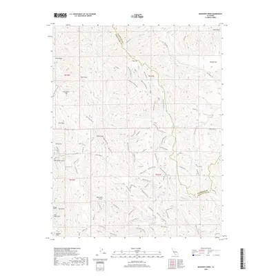
2018 Map of Mississippi Creek
USGS Topo · Published 2018About this map
Divide Ridge and Blue Ridge dominate this section of the Diablo Range, where the boundary between Stanislaus and Santa Clara counties follows the high crests and drainage divides. The landscape is defined by an intricate network of ridgeline trails and deep canyons, including Kelly Cabin Canyon and Soda Springs Canyon. Water resources are localized at points like Bear Springs and Board Springs, which supported early movement through these hills before the modern expansion of larger catchments. Significant water bodies such as Mississippi Lake, Hoover Lake, and Coit Lake anchor the central and southern portions of the quadrangle. The map documents a complex system of historical routes, including the Mississippi Ridge Trail and Pacheco Creek Trail, which trace the same paths used by generations of travelers through the watershed of Mississippi Creek and the South Fork Orestimba Creek.
Find a feature on this map
87 named features on this map. Tap any name to fly to it.
Don’t see what you’re looking for? This feature index may not catch every label — zoom into the map to look around manually.
Map Details
Editions of this 2018 Mississippi Creek Map
This is the sole edition of this map. No revisions or reprints were ever made.
Other maps of this area

1897 · Mt. Hamilton
USGS Topo · 1:62,500

1917 · Morgan Hill
USGS Topo · 1:62,500

1921 · Gilroy Hot Springs
USGS Topo · 1:62,500

1938 · Mt. Boardman
USGS Topo · 1:62,500

1939 · Morgan Hill
USGS Topo · 1:62,500

1939 · Gilroy Hot Springs
USGS Topo · 1:62,500

1940 · Gilroy Hot Springs
USGS Topo · 1:62,500

1941 · Morgan Hill
USGS Topo · 1:62,500

1942 · Mt. Hamilton
USGS Topo · 1:62,500

1942 · Mt. Boardman
USGS Topo · 1:62,500