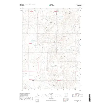
2017 Map of Missouri Buttes
USGS Topo · Published 2017About this map
The Missouri Buttes dominate this high-plains landscape in northern Wyoming, serving as a prominent landmark above the surrounding drainage basins. This 2017 survey shows a complex network of topographical features, including the dramatic Hell Hole and the high point of Butte Divide in the northeast. Water management is central to the area's geography, evidenced by Basin Reservoir Number One and Basin Reservoir Number Two situated near the center of the quadrangle. These reservoirs, alongside the Missouri Buttes Lake, highlight the importance of water catchment in this arid environment.
Find a feature on this map
33 named features on this map. Tap any name to fly to it.
Don’t see what you’re looking for? This feature index may not catch every label — zoom into the map to look around manually.
Map Details
Editions of this 2017 Missouri Buttes Map
This is the sole edition of this map. No revisions or reprints were ever made.
Other maps of this area

1905 · Devils Tower
USGS Topo · 1:125,000

1918 · Moorcroft
USGS Topo · 1:125,000

1918 · Moorcroft
USGS Topo · 1:62,500

1954 · Sunny Divide
USGS Topo · 1:24,000

1954 · Storm Hill
USGS Topo · 1:24,000

1954 · Carlile
USGS Topo · 1:24,000

1954 · Missouri Buttes
USGS Topo · 1:24,000

1954 · Gillette
USGS Topo · 1:250,000

1955 · Devils Tower
USGS Topo · 1:62,500

1955 · Gillette
USGS Topo · 1:250,000