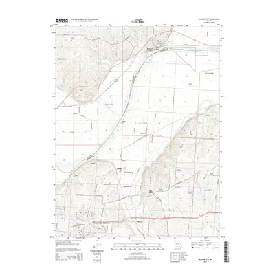
2015 Map of Missouri City
USGS Topo · Published 2015About this map
Missouri City sits at a sharp northern bend in the Missouri River, where the landscape transitions from the broad alluvial plain of Jackson Bend to the elevated terrain of Nebo Hill. This 2015 survey details a region defined by the river's winding course, which serves as the boundary between Clay Co and Jackson Co. The map reveals a dense network of local history, particularly evident in the numerous burial grounds scattered across the bluffs and hills, including Missouri City Cemetery, Franklin Cemetery, and Hudspeth Cemetery.
Find a feature on this map
117 named features on this map. Tap any name to fly to it.
Don’t see what you’re looking for? This feature index may not catch every label — zoom into the map to look around manually.
Map Details
Editions of this 2015 Missouri City Map
This is the sole edition of this map. No revisions or reprints were ever made.
Other maps of this area

1894 · Independence
USGS Topo · 1:125,000

1933 · Blue Springs
USGS Topo · 1:24,000

1934 · Oak Grove
USGS Topo · 1:24,000

1934 · Independence
USGS Topo · 1:24,000

1935 · Buckner
USGS Topo · 1:24,000

1935 · Missouri City
USGS Topo · 1:24,000

1935 · Liberty
USGS Topo · 1:24,000

1936 · Kearney
USGS Topo · 1:48,000

1940 · Liberty
USGS Topo · 1:31,680
1940 · Independence
USGS Topo · 1:31,680