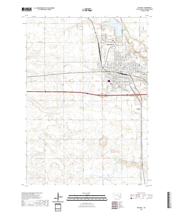
2021 Map of Mitchell
USGS Topo · Published 2021About this map
Mitchell serves as the regional hub for Davison County, displaying a grid of residential and civic development north of the Interstate 90 corridor. The campus of Dakota Wesleyan University stands as a primary landmark in the southern part of the city, while the Davison County Courthouse anchors the central business district. The landscape transition from urban streets to the surrounding James River Valley plains is marked by significant water features, including Lake Mitchell to the north and the meandering courses of Firesteel Cr and Enemy Creek. Local history and genealogy interest is concentrated in a cluster of burial grounds north of the center, including Calvary Cem, Graceland Cem, and the American Legion Cem. Outside the city limits, the terrain is defined by section lines and drainage patterns like Dry Run, illustrating the enduring influence of the Public Land Survey System on South Dakota's geography.
Find a feature on this map
77 named features on this map. Tap any name to fly to it.
Don’t see what you’re looking for? This feature index may not catch every label — zoom into the map to look around manually.
Map Details
Editions of this 2021 Mitchell Map
This is the sole edition of this map. No revisions or reprints were ever made.
Other maps of this area

1899 · Mitchell
USGS Topo · 1:125,000

1899 · Alexandria
USGS Topo · 1:125,000

1955 · Sioux Falls
USGS Topo · 1:250,000

1955 · Mitchell
USGS Topo · 1:250,000

1957 · Ethan
USGS Topo · 1:24,000

1957 · Loomis
USGS Topo · 1:24,000

1957 · Riverside
USGS Topo · 1:24,000

1957 · Farwell
USGS Topo · 1:24,000

1957 · Mitchell
USGS Topo · 1:24,000

1958 · Sioux Falls
USGS Topo · 1:250,000