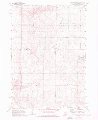
1973 Map of Mittelstedt Slough
USGS Topo · Published 1976About this map
Mittelstedt Slough and Spring Lake anchor this 1970s landscape where the high plains meet the varied wetlands of central South Dakota. The map captures a rural social fabric organized by township-sized areas like Pleasant Valley, Spring Lake, and Marlar. Local gathering points are sparse but significant, including the Ebenezer Ch and a nearby Cem in Pleasant Valley, along with a Sch located at the edge of Spring Lake.
Find a feature on this map
21 named features on this map. Tap any name to fly to it.
Don’t see what you’re looking for? This feature index may not catch every label — zoom into the map to look around manually.
Map Details
Editions of this 1973 Mittelstedt Slough Map
This is the sole edition of this map. No revisions or reprints were ever made.
Other maps of this area

1949 · Vayland SE
USGS Topo · 1:24,000

1949 · Vayland SW
USGS Topo · 1:24,000

1951 · Vayland SW
USGS Topo · 1:24,000

1951 · Vayland SE
USGS Topo · 1:24,000

1953 · Huron
USGS Topo · 1:250,000

1954 · Huron
USGS Topo · 1:250,000

1973 · Big Bend Dam 4 SE
USGS Topo · 1:24,000

1973 · Ames
USGS Topo · 1:24,000

1973 · Gannvalley
USGS Topo · 1:24,000

1973 · Big Bend Dam 4 NE
USGS Topo · 1:24,000