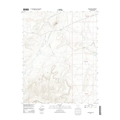
2013 Map of Mitten Rock
USGS Topo · Published 2013About this map
Beautiful Mtn anchors the southwestern reaches of this high-desert landscape in San Juan County, New Mexico. The geography is defined by a series of prominent geological formations and drainage systems that dictate the movement of both water and travelers through the Navajo Nation. To the north, the distinctive Mitten Rock stands as a landmark above the Red Rock Hwy, while the central terrain is characterized by Rock Ridge and the winding course of Dead Mans Wash. The map documents a network of Indian Service Routes and local roads, such as Sanostee Rd, which navigate the elevation changes between the arid flats and the higher mountain slopes. Essential water resources are specifically noted, including Big Gap Reservoir and several named springs like 12R 59 Spring, illustrating the critical infrastructure required for life and livestock in this environment.
Find a feature on this map
18 named features on this map. Tap any name to fly to it.
Don’t see what you’re looking for? This feature index may not catch every label — zoom into the map to look around manually.
Map Details
Editions of this 2013 Mitten Rock Map
This is the sole edition of this map. No revisions or reprints were ever made.
Other maps of this area

1889 · Chaco
USGS Topo · 1:250,000

1892 · Chaco
USGS Topo · 1:250,000

1892 · Canyon De Chelly
USGS Topo · 1:250,000

1934 · Ship Rock
USGS Topo · 1:62,500

1937 · Ship Rock
USGS Topo · 1:62,500

1953 · Sanostee
USGS Topo · 1:62,500

1953 · Redrock Valley NE
USGS Topo · 1:24,000

1953 · Redrock Valley SE
USGS Topo · 1:24,000

1953 · Redrock Valley
USGS Topo · 1:62,500

1954 · Shiprock
USGS Topo · 1:250,000