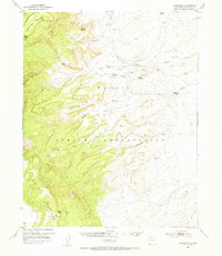
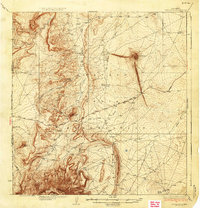
1953 Map of Sanostee
USGS Topo · Published 1954About this map
The Navajo Indian Reservation landscape is defined here by the dramatic rise of the Chuska Mountains and the prominent peak of Beautiful Mountain. This 1950s survey captures a network of arroyos and washes, such as Tocito Wash and Theodore Wash, which dictate the placement of local infrastructure and travel. Human settlement is concentrated at the Sanostee Trading Post and Tocito Trading Post, vital centers of commerce for the community during this era.
Find a feature on this map
22 named features on this map. Tap any name to fly to it.
Don’t see what you’re looking for? This feature index may not catch every label — zoom into the map to look around manually.
Map Details
Editions of this 1953 Sanostee Map
This is the sole edition of this map. No revisions or reprints were ever made.
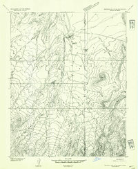
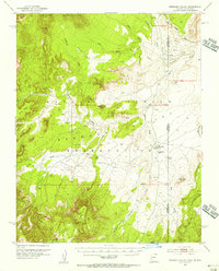
Other maps of this area

1889 · Chaco
USGS Topo · 1:250,000

1892 · Chaco
USGS Topo · 1:250,000

1892 · Canyon De Chelly
USGS Topo · 1:250,000

1927 · Sulphur Spring
USGS Topo · 1:96,000
1928 · Kirtland
USGS Topo · 1:125,000
1932 · Kirtland
USGS Topo · 1:125,000
1934 · Ship Rock
USGS Topo · 1:62,500
1937 · Ship Rock
USGS Topo · 1:62,500
1953 · Redrock Valley SE
USGS Topo · 1:24,000
1953 · Redrock Valley
USGS Topo · 1:62,500