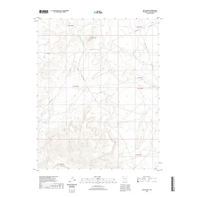
2020 Map of Mitten Rock
USGS Topo · Published 2020About this map
Beautiful Mtn and the iconic Mitten Rock formation dominate the high desert terrain of the Shiprock Agency in San Juan County. This landscape is defined by its drainage systems and water sources, including the winding Dead Mans Wash and Salt Wash, alongside developed infrastructure such as the Big Gap Reservoir. The map illustrates the road network managed by the Indian Service, with routes like Indian Svc Rte 13 and Indian Svc Rte 132 providing essential connectivity across the high plains. Vital water points for the area are noted through specific features like 12R-59 Spring and 12R-61 Spring. The structural layout of the region is further delineated by Rock Ridge, which runs between the arterial Red Valley Hwy and Red Rock Hwy, reflecting the intersection of natural topography and twentieth-century infrastructure development in New Mexico.
Find a feature on this map
22 named features on this map. Tap any name to fly to it.
Don’t see what you’re looking for? This feature index may not catch every label — zoom into the map to look around manually.
Map Details
Editions of this 2020 Mitten Rock Map
This is the sole edition of this map. No revisions or reprints were ever made.
Other maps of this area

1889 · Chaco
USGS Topo · 1:250,000

1892 · Chaco
USGS Topo · 1:250,000

1892 · Canyon De Chelly
USGS Topo · 1:250,000

1934 · Ship Rock
USGS Topo · 1:62,500

1937 · Ship Rock
USGS Topo · 1:62,500

1953 · Sanostee
USGS Topo · 1:62,500

1953 · Redrock Valley NE
USGS Topo · 1:24,000

1953 · Redrock Valley SE
USGS Topo · 1:24,000

1953 · Redrock Valley
USGS Topo · 1:62,500

1954 · Shiprock
USGS Topo · 1:250,000