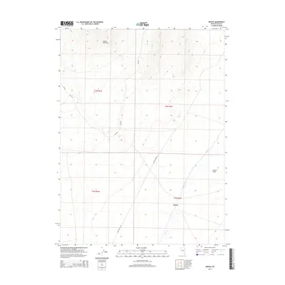
2014 Map of Mizpah
USGS Topo · Published 2014About this map
The Pequop Mountains dominate the northwestern skyline of this high-desert landscape in Elko County, Nevada. The terrain transitions from these jagged heights down into the wide expanse of the Steptoe Valley to the southeast. The small settlement of Mizpah sits at the heart of this region, serving as a focal point near the intermittent flow of Nelson Cr. A network of Bureau of Land Management routes, including Blm-1055 and Blm-1023, crisscross the area, reflecting the modern management of these traditional ranching and grazing lands. Further south, the Goshute Valley RD provides a primary corridor through the flats, marking the boundary between the rugged mountain slopes and the alluvial plains characteristic of the Great Basin's basin-and-range topography.
Find a feature on this map
12 named features on this map. Tap any name to fly to it.
Don’t see what you’re looking for? This feature index may not catch every label — zoom into the map to look around manually.
Map Details
Editions of this 2014 Mizpah Map
This is the sole edition of this map. No revisions or reprints were ever made.
Other maps of this area

1953 · Spruce Mountain
USGS Topo · 1:62,500

1953 · Spruce Mountain 4
USGS Topo · 1:62,500

1955 · Elko
USGS Topo · 1:250,000

1958 · Elko
USGS Topo · 1:250,000

1962 · Elko
USGS Topo · 1:250,000

1965 · Elko
USGS Topo · 1:250,000

1982 · Currie
USGS Topo · 1:24,000

1982 · Sharp Peak
USGS Topo · 1:24,000

1982 · Mizpah
USGS Topo · 1:24,000
1982 · Mizpah Point
USGS Topo · 1:24,000