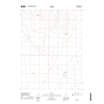
2018 Map of Mizpah
USGS Topo · Published 2018About this map
Steptoe Valley and the southern reaches of the Pequop Mountains dominate this high-desert landscape in Elko County. The map documents the sparse settlement of Mizpah, positioned at a junction where the open valley floor meets the rising mountain slopes. This 2018 survey reveals a network of land management tracks, including Goshute Valley Rd and various Bureau of Land Management routes like Blm Rd 1055, which follow the natural contours of the basin. The presence of Nelson Cr cutting through the valley highlights the critical role of intermittent water sources in this arid environment. The map provides a clear record of the Public Land Survey System grid across these townships, illustrating how historical property boundaries were superimposed over the basin-and-range topography.
Find a feature on this map
12 named features on this map. Tap any name to fly to it.
Don’t see what you’re looking for? This feature index may not catch every label — zoom into the map to look around manually.
Map Details
Editions of this 2018 Mizpah Map
This is the sole edition of this map. No revisions or reprints were ever made.
Other maps of this area

1953 · Spruce Mountain
USGS Topo · 1:62,500

1953 · Spruce Mountain 4
USGS Topo · 1:62,500

1955 · Elko
USGS Topo · 1:250,000

1958 · Elko
USGS Topo · 1:250,000

1962 · Elko
USGS Topo · 1:250,000

1965 · Elko
USGS Topo · 1:250,000

1982 · Currie
USGS Topo · 1:24,000

1982 · Sharp Peak
USGS Topo · 1:24,000

1982 · Mizpah
USGS Topo · 1:24,000
1982 · Mizpah Point
USGS Topo · 1:24,000