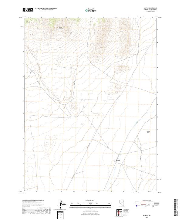
2021 Map of Mizpah
USGS Topo · Published 2021About this map
Steptoe Valley and the high ridges of the Pequop Mountains define this high-desert region of Elko County, where historical land use is marked by a network of public land access routes and isolated settlements. The site of Mizpah sits at the intersection of Bureau of Land Management roads and the Goshute Valley Rd, providing a clear record of the area's twentieth-century transportation corridors. Ephemeral hydrology is represented by Nelson Cr, which cuts through the valley floor toward the eastern edge of the quadrangle. This 2021 update preserves the exact Public Land Survey System boundaries, including t30n r64e, t30n r65e, t29n r64e, and t29n r65e, documenting the foundational cadastral grid that continues to organize this part of the Great Basin.
Find a feature on this map
12 named features on this map. Tap any name to fly to it.
Don’t see what you’re looking for? This feature index may not catch every label — zoom into the map to look around manually.
Map Details
Editions of this 2021 Mizpah Map
This is the sole edition of this map. No revisions or reprints were ever made.
Other maps of this area

1953 · Spruce Mountain
USGS Topo · 1:62,500

1953 · Spruce Mountain 4
USGS Topo · 1:62,500

1955 · Elko
USGS Topo · 1:250,000

1958 · Elko
USGS Topo · 1:250,000

1962 · Elko
USGS Topo · 1:250,000

1965 · Elko
USGS Topo · 1:250,000

1982 · Currie
USGS Topo · 1:24,000

1982 · Sharp Peak
USGS Topo · 1:24,000

1982 · Mizpah
USGS Topo · 1:24,000
1982 · Mizpah Point
USGS Topo · 1:24,000