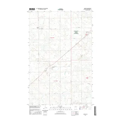
2016 Map of Mizpah
USGS Topo · Published 2016About this map
Mizpah and the nearby settlement of Gemmell anchor this northern Minnesota survey, characterized by a complex network of wetlands and small water bodies. The terrain is defined by the winding course of Caldwell Brook and the presence of Girl Lake to the north. Local history is preserved through the mapping of the Mizpah Cem and the Forest Grove Cem, which serves the small community of Forest Grove along West Co RD 17. The landscape reflects a mix of remote wilderness and agricultural management, most notably seen in the large tract designated as Farm Service Agency Interest of Minnesota. Transportation is limited to a handful of numbered county roads and unmaintained tracks like Ut-38 and Ut-39, illustrating the rural, sparsely populated nature of Koochiching County.
Find a feature on this map
40 named features on this map. Tap any name to fly to it.
Don’t see what you’re looking for? This feature index may not catch every label — zoom into the map to look around manually.
Map Details
Editions of this 2016 Mizpah Map
This is the sole edition of this map. No revisions or reprints were ever made.
Other maps of this area

1919 · Lundgren
USGS Topo · 1:62,500

1919 · Gemmell
USGS Topo · 1:62,500

1919 · Norden
USGS Topo · 1:62,500

1919 · Bridgie
USGS Topo · 1:62,500

1924 · Bridgie
USGS Topo · 1:62,500

1954 · Bemidji
USGS Topo · 1:250,000

1954 · Roseau
USGS Topo · 1:250,000

1957 · Roseau
USGS Topo · 1:250,000

1957 · Bemidji
USGS Topo · 1:250,000

1958 · Bemidji
USGS Topo · 1:250,000