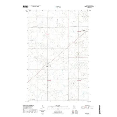
2019 Map of Mizpah
USGS Topo · Published 2019About this map
Mizpah and Northome anchor this Koochiching County landscape, defined by a network of rural roads and the winding path of Caldwell Brook. The settlement pattern reflects the persistent small-town character of northern Minnesota, where community life centers on intersections like Gemmell and Forest Grove. Genealogists and local researchers will find significant landmarks including the Mizpah Cemetery and the Forest Grove Cemetery, providing essential coordinates for tracing family roots in the region. The map details an extensive system of unpaved and county roads, such as Town Rd 7 and Blueberry Rd, which navigate the wetlands and timberlands. These routes, including Bartlett Ave and Itasca St, illustrate the local infrastructure that connects isolated homesteads and small townships across the t151n r28w and t152n r28w township grids.
Find a feature on this map
38 named features on this map. Tap any name to fly to it.
Don’t see what you’re looking for? This feature index may not catch every label — zoom into the map to look around manually.
Map Details
Editions of this 2019 Mizpah Map
This is the sole edition of this map. No revisions or reprints were ever made.
Other maps of this area

1919 · Lundgren
USGS Topo · 1:62,500

1919 · Gemmell
USGS Topo · 1:62,500

1919 · Norden
USGS Topo · 1:62,500

1919 · Bridgie
USGS Topo · 1:62,500

1924 · Bridgie
USGS Topo · 1:62,500

1954 · Bemidji
USGS Topo · 1:250,000

1954 · Roseau
USGS Topo · 1:250,000

1957 · Roseau
USGS Topo · 1:250,000

1957 · Bemidji
USGS Topo · 1:250,000

1958 · Bemidji
USGS Topo · 1:250,000