
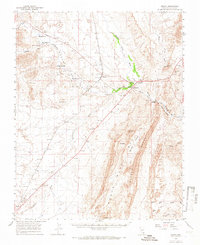
1958 Map of Moapa
USGS Topo · Published 1959About this map
Moapa River Indian Reservation dominates the upper reaches of the valley where the Muddy River flows through the desert landscape of southern Nevada. In the late 1950s, this area functioned as a vital corridor for the Union Pacific railroad, which tracks through settlements such as Moapa and Ute. The map reveals a transition from agricultural life at Home Ranch and Searles Ranch to the striking geological formations of the Muddy Mountains and Weiser Ridge.
Find a feature on this map
45 named features on this map. Tap any name to fly to it.
Don’t see what you’re looking for? This feature index may not catch every label — zoom into the map to look around manually.
Map Details
Editions of this 1958 Moapa Map
2 editions found
Other maps of this area

1886 · Saint Thomas
USGS Topo · 1:250,000

1893 · Saint Thomas
USGS Topo · 1:250,000

1926 · Bonelli
USGS Topo · 1:96,000

1926 · Boulder Canyon
USGS Topo · 1:96,000

1952 · Dry Lake
USGS Topo · 1:62,500

1953 · Muddy Peak
USGS Topo · 1:62,500

1953 · Overton Beach
USGS Topo · 1:62,500

1954 · Las Vegas
USGS Topo · 1:250,000

1957 · Las Vegas
USGS Topo · 1:250,000

1958 · Arrow Canyon
USGS Topo · 1:62,500