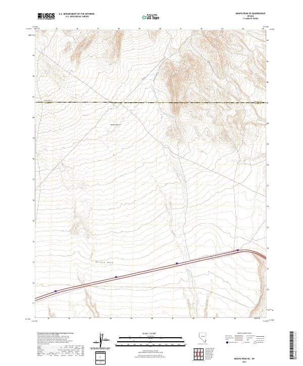
2021 Map of Moapa Peak SE
USGS Topo · Published 2021About this map
Mormon Mesa dominates the southern portion of this landscape, rising above the arid expanse of the Mojave Desert near the border of Clark and Lincoln counties. The terrain is defined by the drainage of Halfway Wash, which cuts a path northward through the center of the sheet. Sparse infrastructure characterizes the area, consisting primarily of remote desert tracks such as S Fork Rd, Halfway Wash Rd, and the Toquop Access Rd. The map illustrates the vast, undeveloped stretches of the eastern Nevada desert, where the natural topography and drainage patterns are the primary features of interest for those studying the physical geography of the region.
Find a feature on this map
13 named features on this map. Tap any name to fly to it.
Don’t see what you’re looking for? This feature index may not catch every label — zoom into the map to look around manually.
Map Details
Editions of this 2021 Moapa Peak SE Map
This is the sole edition of this map. No revisions or reprints were ever made.
Other maps of this area

1886 · Saint Thomas
USGS Topo · 1:250,000

1893 · Saint Thomas
USGS Topo · 1:250,000

1954 · Las Vegas
USGS Topo · 1:250,000

1957 · Las Vegas
USGS Topo · 1:250,000

1957 · Mesquite
USGS Topo · 1:62,500

1958 · Virgin Peak
USGS Topo · 1:62,500

1958 · Overton
USGS Topo · 1:62,500

1959 · Las Vegas
USGS Topo · 1:250,000

1962 · Las Vegas
USGS Topo · 1:250,000
1969 · Moapa Peak
USGS Topo · 1:24,000