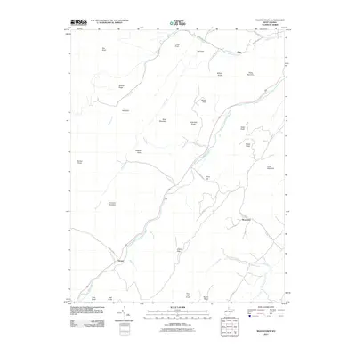
2011 Map of Moatstown
USGS Topo · Published 2011About this map
The South Branch Potomac River winds through this section of Pendleton County, carving a narrow valley floor that supports small settlements like Harper and Moatstown. The terrain is defined by high elevations and dramatic gaps, such as Moyer Gap and Liberty Gap, which have historically dictated the placement of roads and human passage through the highlands. A series of prominent knobs and ridges frame the river corridor, including Simmons Mountain, Ruleman Mountain, and Pickle Mountain. Narrow watercourses like Hammer Run and Moyer Run feed into the main river branch from the surrounding slopes. The layout of County Hwy-25 and County Hwy-18 follows the natural contours of the land, connecting isolated locales such as Zigler to the broader regional network. Notable landmarks like the Cave and various named knobs such as Castle Knob and Kile Knob serve as distinct points of reference in this deeply ridged landscape.
Find a feature on this map
45 named features on this map. Tap any name to fly to it.
Don’t see what you’re looking for? This feature index may not catch every label — zoom into the map to look around manually.
Map Details
Editions of this 2011 Moatstown Map
This is the sole edition of this map. No revisions or reprints were ever made.
Other maps of this area

1889 · Beverly
USGS Topo · 1:125,000

1892 · Beverly
USGS Topo · 1:125,000

1892 · Franklin
USGS Topo · 1:125,000

1894 · Staunton
USGS Topo · 1:125,000

1896 · Franklin
USGS Topo · 1:125,000

1901 · Monterey
USGS Topo · 1:125,000

1922 · Spruce Knob
USGS Topo · 1:48,000

1922 · Circleville
USGS Topo · 1:62,500

1924 · Circleville
USGS Topo · 1:48,000

1924 · Mc Dowell
USGS Topo · 1:62,500