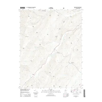
2014 Map of Moatstown
USGS Topo · Published 2014About this map
The South Branch Potomac River flows through a landscape defined by significant elevations and agricultural traditions in this part of Pendleton County. The small settlements of Moatstown, Harper, and Zigler are situated along the river valley and its tributary gaps, surrounded by the protected lands of the Monongahela National Forest. Evidence of long-standing family landholdings is visible through numerous named springs, including the Rexrode Farm Spring, Moyer Farm Spring, and Sennett Farm Spring, which provided essential water sources for upland farms. The terrain is marked by a series of prominent peaks and ridges such as North Fork Mtn, Panther Knob, and Ruleman Mtn, which create a rugged backdrop for the river's path. Transport in this period relies heavily on Us-220, which follows the river's winding course, and smaller local routes like Smith Creek Rd and Black Thorn Rd that penetrate the mountain gaps.
Find a feature on this map
55 named features on this map. Tap any name to fly to it.
Don’t see what you’re looking for? This feature index may not catch every label — zoom into the map to look around manually.
Map Details
Editions of this 2014 Moatstown Map
This is the sole edition of this map. No revisions or reprints were ever made.
Other maps of this area

1889 · Beverly
USGS Topo · 1:125,000

1892 · Beverly
USGS Topo · 1:125,000

1892 · Franklin
USGS Topo · 1:125,000

1894 · Staunton
USGS Topo · 1:125,000

1896 · Franklin
USGS Topo · 1:125,000

1901 · Monterey
USGS Topo · 1:125,000

1922 · Spruce Knob
USGS Topo · 1:48,000

1922 · Circleville
USGS Topo · 1:62,500

1924 · Circleville
USGS Topo · 1:48,000

1924 · Mc Dowell
USGS Topo · 1:62,500