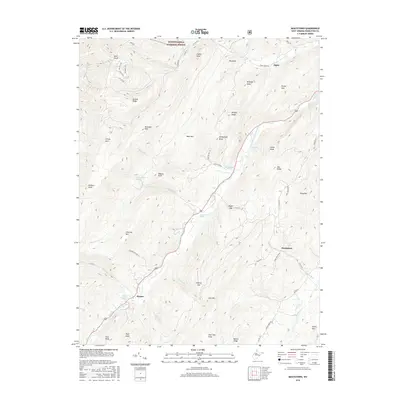
2016 Map of Moatstown
USGS Topo · Published 2016About this map
The South Branch Potomac River carves a deep valley through the high ridges of Pendleton County, anchoring a landscape where agricultural life clings to the narrow riverside flats. In this part of the Monongahela National Forest, small settlements like Moatstown, Harper, and Zigler serve as local touchstones for a community defined by its topography. The prevalence of named water sources, such as Moyer Farm Spring, Sennett Farm Spring, and Hammer Run Spring, indicates the vital importance of reliable springs for farmsteads situated between the steep slopes of N Fork Mtn and Jack Mtn. Roads like Smith Creek Rd and Moyer Run Rd follow the natural contours of the land, connecting these mountain gaps and ridges. This map documents a traditional Appalachian mountain-and-valley settlement pattern, where family names are etched into the land via features like Wilfong Knob, Wagner Knob, and Rexrode Farm Spring.
Find a feature on this map
68 named features on this map. Tap any name to fly to it.
Don’t see what you’re looking for? This feature index may not catch every label — zoom into the map to look around manually.
Map Details
Editions of this 2016 Moatstown Map
This is the sole edition of this map. No revisions or reprints were ever made.
Other maps of this area

1889 · Beverly
USGS Topo · 1:125,000

1892 · Beverly
USGS Topo · 1:125,000

1892 · Franklin
USGS Topo · 1:125,000

1894 · Staunton
USGS Topo · 1:125,000

1896 · Franklin
USGS Topo · 1:125,000

1901 · Monterey
USGS Topo · 1:125,000

1922 · Spruce Knob
USGS Topo · 1:48,000

1922 · Circleville
USGS Topo · 1:62,500

1924 · Circleville
USGS Topo · 1:48,000

1924 · Mc Dowell
USGS Topo · 1:62,500