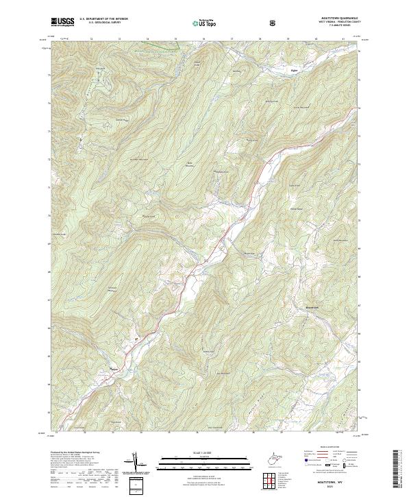
2023 Map of Moatstown
USGS Topo · Published 2023About this map
The South Branch Potomac River carves a central path through this section of the Monongahela National Forest, defining the settlement patterns of Pendleton County. Small communities such as Moatstown, Zigler, and Harper are situated in the lower elevations, often near the springs and runs that flow from the surrounding peaks. The map reveals a landscape of high ridges and named knobs, including Ruleman Mountain, Kile Knob, and Pickle Mountain, which flank the river valley. Local agricultural history is evidenced by specific sites like the Moyer Farm Spring and Rexrode Farm Spring, while the road network, including Smith Creek Rd and Moyer Run Rd, follows the natural gaps and hollows like Moyer Gap and Liberty Gap. This topography illustrates how the Appalachian terrain has historically constrained and directed development along the river's course.
Find a feature on this map
57 named features on this map. Tap any name to fly to it.
Don’t see what you’re looking for? This feature index may not catch every label — zoom into the map to look around manually.
Map Details
Editions of this 2023 Moatstown Map
This is the sole edition of this map. No revisions or reprints were ever made.
Other maps of this area

1889 · Beverly
USGS Topo · 1:125,000

1892 · Beverly
USGS Topo · 1:125,000

1892 · Franklin
USGS Topo · 1:125,000

1894 · Staunton
USGS Topo · 1:125,000

1896 · Franklin
USGS Topo · 1:125,000

1901 · Monterey
USGS Topo · 1:125,000

1922 · Spruce Knob
USGS Topo · 1:48,000

1922 · Circleville
USGS Topo · 1:62,500

1924 · Circleville
USGS Topo · 1:48,000

1924 · Mc Dowell
USGS Topo · 1:62,500