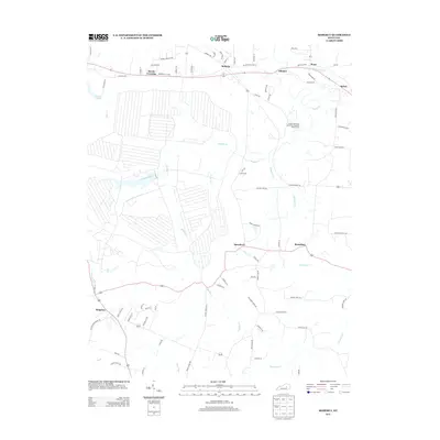
2013 Map of Moberly
USGS Topo · Published 2013About this map
Moberly and the surrounding agricultural lands of Madison County are defined by a complex network of waterways, most notably the meandering course of Muddy Cr. In the northern section, the community of Waco sits near Sand Spring Br, while the eastern landscape is anchored by the Eastern Kentucky University Meadow Brook Farm. This area preserves a traditional Central Kentucky settlement pattern, with small clusters like Bybee and Elliston connected by historic routes such as Old Kentucky Hwy 52. To the south, the terrain becomes more distinct near the Cedar Cliff Flts and the valley of Drowning Cr. Notable landmarks for local researchers include the community of Kingston at the intersection near Hays Fork, and several family-named roads like Millirons Rd and Hume Branch Rd that suggest long-standing land divisions and local genealogy.
Find a feature on this map
83 named features on this map. Tap any name to fly to it.
Don’t see what you’re looking for? This feature index may not catch every label — zoom into the map to look around manually.
Map Details
Editions of this 2013 Moberly Map
This is the sole edition of this map. No revisions or reprints were ever made.
Other maps of this area

1892 · Richmond
USGS Topo · 1:125,000

1897 · Richmond
USGS Topo · 1:125,000

1952 · Alcorn
USGS Topo · 1:24,000

1952 · Berea
USGS Topo · 1:24,000

1952 · Union City
USGS Topo · 1:24,000

1952 · Palmer
USGS Topo · 1:24,000

1952 · Richmond North
USGS Topo · 1:24,000

1952 · Bighill
USGS Topo · 1:24,000

1952 · Panola
USGS Topo · 1:24,000

1952 · Moberly
USGS Topo · 1:24,000