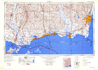
1984 Map of Mobile
USGS Topo · Published 1984About this map
The Mobile riverfront and the industrial sprawl of the central Gulf Coast anchor this 1984 regional study. From the shipping hubs of Pascagoula and Gulfport to the edges of New Orleans, the map documents a landscape defined by its transition from deep-water ports to the dense timber of De Soto National Forest. The influence of the Cold War and the space race is visible in the presence of the Wolf Branch Test Facility and Michoud Assembly Facility, while Keesler Air Force Base remains a dominant fixture on the Biloxi shoreline. Coastal connectivity is highlighted by the Intracoastal Waterway and the Louisville & Nashville RR, tracing the delicate barrier islands including Ship Island, Horn Island, and Dauphin Island that separate the Mississippi Sound from the open Gulf of Mexico. Smaller settlements like Bayou La Batre and Coden reflect the region's enduring maritime character along the Mississippi and Alabama borders.
Find a feature on this map
67 named features on this map. Tap any name to fly to it.
Don’t see what you’re looking for? This feature index may not catch every label — zoom into the map to look around manually.
Map Details
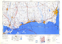
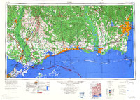
Editions of this 1984 Mobile Map
3 editions found
Other maps of this area

1891 · Spanish Fort
USGS Topo · 1:62,500

1891 · New Orleans
USGS Topo · 1:62,500

1892 · Chef Menteur
USGS Topo · 1:62,500

1892 · St. Bernard
USGS Topo · 1:62,500

1893 · Cat Island
USGS Topo · 1:62,500

1893 · Rigolets
USGS Topo · 1:62,500

1893 · Chandeleur
USGS Topo · 1:62,500

1893 · Shell Beach
USGS Topo · 1:62,500

1893 · Toulme
USGS Topo · 1:62,500

1895 · Bodreau
USGS Topo · 1:62,500