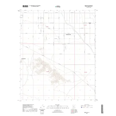
2018 Map of Mobile NW
USGS Topo · Published 2018About this map
Rainbow Valley serves as a focal point for this desert landscape, where the northern sections are defined by a sprawling grid of rural roads and residential development expanding from Goodyear and Buckeye. The desert floor is bisected by Waterman Wash, which meanders from the northeast toward the south, providing a natural break in the man-made geometry of W Ocotillo Rd and Baseline Rd.
Find a feature on this map
46 named features on this map. Tap any name to fly to it.
Don’t see what you’re looking for? This feature index may not catch every label — zoom into the map to look around manually.
Map Details
Editions of this 2018 Mobile NW Map
This is the sole edition of this map. No revisions or reprints were ever made.
Other maps of this area

1946 · Avondale
USGS Topo · 1:62,500

1948 · Cashion
USGS Topo · 1:62,500

1951 · Mobile
USGS Topo · 1:62,500

1951 · Cotton Center
USGS Topo · 1:62,500

1954 · Phoenix
USGS Topo · 1:250,000

1957 · Phoenix
USGS Topo · 1:250,000

1957 · Avondale SW
USGS Topo · 1:24,000
1957 · Avondale SE
USGS Topo · 1:24,000

1958 · Phoenix
USGS Topo · 1:250,000

1958 · Buckeye
USGS Topo · 1:24,000