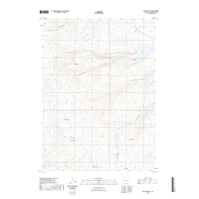
2021 Map of Moccasin Lake
USGS Topo · Published 2021About this map
Mt Popo Agie and Mt Cross dominate the high-elevation landscape of this Fremont County region, where the steep terrain of the Wind River Range is carved by numerous alpine drainages. The South Fork Little Wind River flows through the northern reaches, feeding into the Washakie Reservoir, while the southern portion of the quadrangle is defined by the headwaters of Moccasin Creek and Trout Creek. This area's geography is shaped by its primitive access routes and seasonal water sources like Blue Spring. Local travel is largely restricted to the Washakie Park Road and Moccasin Lake Road, reflecting the area's use for recreation and land management within the reservation boundaries. Mosquito Park and high-altitude lakes such as Little Moccasin Lake and Shoe Lake provide specific points of interest for those tracing the traditional trails and land use patterns of this mountain wilderness.
Find a feature on this map
26 named features on this map. Tap any name to fly to it.
Don’t see what you’re looking for? This feature index may not catch every label — zoom into the map to look around manually.
Map Details
Editions of this 2021 Moccasin Lake Map
This is the sole edition of this map. No revisions or reprints were ever made.
Other maps of this area

1937 · Moccasin Lake
USGS Topo · 1:48,000

1943 · Moccasin Lake
USGS Topo · 1:62,500

1951 · Fort Washakie
USGS Topo · 1:24,000

1952 · Wise Flat
USGS Topo · 1:24,000

1952 · Wind River
USGS Topo · 1:24,000

1952 · St. Lawrence Basin
USGS Topo · 1:24,000

1953 · Mount Arter
USGS Topo · 1:24,000

1955 · Thermopolis
USGS Topo · 1:250,000

1955 · Lander
USGS Topo · 1:250,000

1958 · Lander
USGS Topo · 1:250,000