
1952 Map of Wind River
USGS Topo · Published 1954About this map
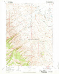
Indian Cem (Grave of Sacajawea) serves as a significant historical anchor within the Wind River Indian Reservation, marking the burial site of the famed Shoshone guide. This 1952 landscape is defined by the complex water systems supporting the arid terrain, including the Ray Canal, Dead Horse Slough, and the Fort Washakie Underground Reservoir. The settlement of Wind River and the Roberts Mission are positioned along the fertile corridor where Crooked Creek meets Trout Creek. The irrigation network, indicated by various ditches and flumes, highlights the agricultural efforts of the era. To the south, the topography rises sharply toward Cedar Butte, with rugged drainage systems like Cottonwood Creek and Surrell Creek carving deep valleys through the high plateaus. This map captures a moment of established community and managed resources in the Wind River Basin just after the mid-century.
Find a feature on this map
22 named features on this map. Tap any name to fly to it.
Don’t see what you’re looking for? This feature index may not catch every label — zoom into the map to look around manually.
Map Details
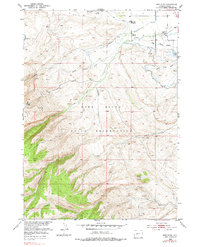
Editions of this 1952 Wind River Map
3 editions found
Other maps of this area

1937 · Moccasin Lake
USGS Topo · 1:48,000

1943 · Moccasin Lake
USGS Topo · 1:62,500

1951 · Fort Washakie
USGS Topo · 1:24,000

1951 · Ethete
USGS Topo · 1:24,000

1952 · Wise Flat
USGS Topo · 1:24,000

1952 · Ray Lake
USGS Topo · 1:24,000

1953 · Mount Arter
USGS Topo · 1:24,000

1953 · Mount Arter SE
USGS Topo · 1:24,000

1955 · Thermopolis
USGS Topo · 1:250,000

1955 · Lander
USGS Topo · 1:250,000