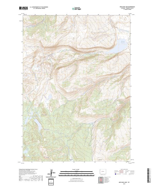
2023 Map of Moccasin Lake
USGS Topo · Published 2023About this map
Washakie Reservoir and the high peaks of the Wind River Range dominate this alpine portion of Fremont County. The terrain is defined by dramatic elevation changes, rising toward prominent summits like Mt Popo Agie and Mt Cross, as well as the broad Bald Mtn to the south. Numerous high-altitude water bodies, including Pie Lake, Little Moccasin Lake, and Marys Lake, are fed by a complex network of streams such as Moccasin Creek and Trout Creek. These glacial lakes and tributaries form the headwaters of the South Fork Little Wind River, which cuts through the northern sections of the landscape. While primarily characterized by its remote hydrological and geological features, the area is accessed via Moccasin Lake Rd and Washakie Park Rd, providing a framework for understanding the transit into this high mountain environment.
Find a feature on this map
22 named features on this map. Tap any name to fly to it.
Don’t see what you’re looking for? This feature index may not catch every label — zoom into the map to look around manually.
Map Details
Editions of this 2023 Moccasin Lake Map
This is the sole edition of this map. No revisions or reprints were ever made.
Other maps of this area

1937 · Moccasin Lake
USGS Topo · 1:48,000

1943 · Moccasin Lake
USGS Topo · 1:62,500

1951 · Fort Washakie
USGS Topo · 1:24,000

1952 · Wise Flat
USGS Topo · 1:24,000

1952 · Wind River
USGS Topo · 1:24,000

1952 · St. Lawrence Basin
USGS Topo · 1:24,000

1953 · Mount Arter
USGS Topo · 1:24,000

1955 · Thermopolis
USGS Topo · 1:250,000

1955 · Lander
USGS Topo · 1:250,000

1958 · Lander
USGS Topo · 1:250,000