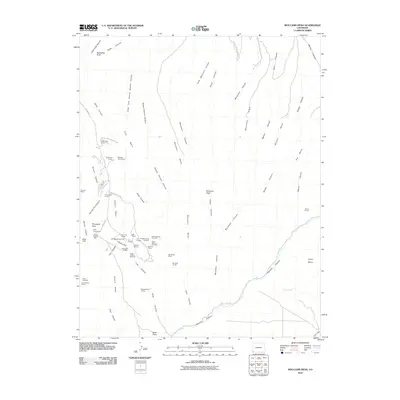
2010 Map of Moccasin Mesa
USGS Topo · Published 2010About this map
Ancient cliff dwellings and ancestral structures populate the high plateaus of Mesa Verde National Park on this topographic survey. The landscape is defined by a series of south-reaching landforms including Chapin Mesa, Moccasin Mesa, and Whites Mesa, separated by deep drainage systems like Soda Canyon and Morefield Canyon. These mesas hold significant archaeological sites, ranging from the complex architecture of Cliff Palace and Spruce Tree House to more isolated sites such as House of Many Windows, Boneawl House, and Inaccessible House.
Find a feature on this map
66 named features on this map. Tap any name to fly to it.
Don’t see what you’re looking for? This feature index may not catch every label — zoom into the map to look around manually.
Map Details
Editions of this 2010 Moccasin Mesa Map
This is the sole edition of this map. No revisions or reprints were ever made.
Other maps of this area

1912 · Soda Canyon
USGS Topo · 1:62,500

1915 · Soda Canyon
USGS Topo · 1:62,500

1956 · Cortez
USGS Topo · 1:250,000

1958 · Cortez
USGS Topo · 1:250,000

1959 · Cortez
USGS Topo · 1:250,000

1962 · Cortez
USGS Topo · 1:250,000

1965 · Cortez
USGS Topo · 1:24,000
1965 · Mancos
USGS Topo · 1:24,000
1965 · Point Lookout
USGS Topo · 1:24,000

1966 · Cortez
USGS Topo · 1:250,000