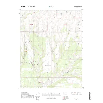
2019 Map of Moccasin Mesa
USGS Topo · Published 2019About this map
Mesa Verde National Park anchors this topography, where the high desert plateaus are deeply incised by a network of drainage systems. The map illustrates the concentrated archaeological significance of Chapin Mesa, identifying world-renowned sites like Cliff Palace and the Sun Temple. These features are connected by the Mesa Top Loop road, providing a detailed perspective on the spatial relationship between the canyon dwellings and the plateau surface.
Find a feature on this map
50 named features on this map. Tap any name to fly to it.
Don’t see what you’re looking for? This feature index may not catch every label — zoom into the map to look around manually.
Map Details
Editions of this 2019 Moccasin Mesa Map
This is the sole edition of this map. No revisions or reprints were ever made.
Other maps of this area

1912 · Soda Canyon
USGS Topo · 1:62,500

1915 · Soda Canyon
USGS Topo · 1:62,500

1956 · Cortez
USGS Topo · 1:250,000

1958 · Cortez
USGS Topo · 1:250,000

1959 · Cortez
USGS Topo · 1:250,000

1962 · Cortez
USGS Topo · 1:250,000

1965 · Cortez
USGS Topo · 1:24,000
1965 · Mancos
USGS Topo · 1:24,000
1965 · Point Lookout
USGS Topo · 1:24,000

1966 · Cortez
USGS Topo · 1:250,000