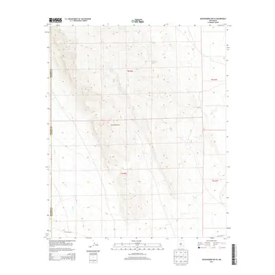
2013 Map of Mockingbird Gap SE
USGS Topo · Published 2013About this map
Oscura Mountains terrain dominates this 2013 survey of the high desert along the border of Socorro and Lincoln counties. The landscape is defined by its scarce water sources, marked by essential points like Cottonwood Spring, Keller Spring, and the evocatively named Palomas Moonshine Spring. These springs and catchments like Woods Tank illustrate the historical reliance on isolated water rights in this arid region. On the eastern slopes, the label for Estey City marks a site of early twentieth-century mining interest, where copper extraction once drew settlers to this remote stretch of New Mexico. The presence of WSMR P Route 12 at the southern edge indicates the area's proximity to military range lands, while the drainage of Salt Cr cuts through the western flats, tracing the natural hydrologic patterns of the basin.
Find a feature on this map
14 named features on this map. Tap any name to fly to it.
Don’t see what you’re looking for? This feature index may not catch every label — zoom into the map to look around manually.
Map Details
Editions of this 2013 Mockingbird Gap SE Map
This is the sole edition of this map. No revisions or reprints were ever made.
Other maps of this area

1916 · Tularosa
USGS Topo · 1:125,000

1918 · Oscura Peak
USGS Topo · 1:125,000

1947 · Three Rivers
USGS Topo · 1:62,500

1947 · Capitol Peak
USGS Topo · 1:62,500

1948 · Chihuahua Ranch
USGS Topo · 1:62,500

1948 · Mockingbird Gap
USGS Topo · 1:62,500

1954 · Tularosa
USGS Topo · 1:250,000

1958 · Tularosa
USGS Topo · 1:250,000
1981 · Bull Gap SW
USGS Topo · 1:24,000

1981 · Tularosa
USGS Topo · 1:100,000