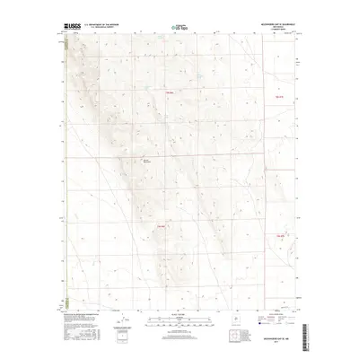
2017 Map of Mockingbird Gap SE
USGS Topo · Published 2017About this map
The Oscura Mountains dominate this high-desert landscape along the boundary of Socorro and Lincoln County. In this arid environment, water sources are the primary markers of human and livestock presence, indicated by several named springs and catchments. Keller Spring and Palomas Moonshine Spring are positioned in the higher elevations, while Cottonwood Spring and man-made structures like Woods Tank and Kidd Tank are situated lower in the basin. The drainage of Salt Cr cuts through the western reaches of the quadrangle. This map reflects a region defined by its rugged topography and the essential infrastructure required for ranching and survival in the New Mexico backcountry.
Find a feature on this map
12 named features on this map. Tap any name to fly to it.
Don’t see what you’re looking for? This feature index may not catch every label — zoom into the map to look around manually.
Map Details
Editions of this 2017 Mockingbird Gap SE Map
This is the sole edition of this map. No revisions or reprints were ever made.
Other maps of this area

1916 · Tularosa
USGS Topo · 1:125,000

1918 · Oscura Peak
USGS Topo · 1:125,000

1947 · Three Rivers
USGS Topo · 1:62,500

1947 · Capitol Peak
USGS Topo · 1:62,500

1948 · Chihuahua Ranch
USGS Topo · 1:62,500

1948 · Mockingbird Gap
USGS Topo · 1:62,500

1954 · Tularosa
USGS Topo · 1:250,000

1958 · Tularosa
USGS Topo · 1:250,000
1981 · Bull Gap SW
USGS Topo · 1:24,000

1981 · Tularosa
USGS Topo · 1:100,000