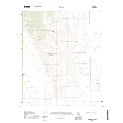
2023 Map of Mockingbird Gap SE
USGS Topo · Published 2023About this map
White Sands Missile Range dominates the southern landscape of this New Mexico quadrangle, where restricted military lands intersect with the high desert terrain of the Oscura Mountains. The map reveals a delicate network of desert water sources essential for survival in this arid environment, including Cottonwood Spring and Keller Spring in the northern reaches, and the curiously named Palomas Moonshine Spring situated further east. The western edge is defined by the drainage of Salt Creek, while the presence of the WSMR P Rt 12 road and the boundary between Socorro and Lincoln counties highlight the intersection of military logistics and civil administrative lines. This survey provides a precise accounting of the topographical features within a heavily controlled zone where public access is traditionally limited.
Find a feature on this map
14 named features on this map. Tap any name to fly to it.
Don’t see what you’re looking for? This feature index may not catch every label — zoom into the map to look around manually.
Map Details
Editions of this 2023 Mockingbird Gap SE Map
This is the sole edition of this map. No revisions or reprints were ever made.
Other maps of this area

1916 · Tularosa
USGS Topo · 1:125,000

1918 · Oscura Peak
USGS Topo · 1:125,000

1947 · Three Rivers
USGS Topo · 1:62,500

1947 · Capitol Peak
USGS Topo · 1:62,500

1948 · Chihuahua Ranch
USGS Topo · 1:62,500

1948 · Mockingbird Gap
USGS Topo · 1:62,500

1954 · Tularosa
USGS Topo · 1:250,000

1958 · Tularosa
USGS Topo · 1:250,000
1981 · Bull Gap SW
USGS Topo · 1:24,000

1981 · Tularosa
USGS Topo · 1:100,000