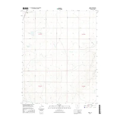
2016 Map of Model
USGS Topo · Published 2016About this map
Model sits in the northwest corner of this high plains survey, marking a distinct settlement point along the regional road network. The landscape is defined by the drainage patterns of the Purgatoire River in the south and various seasonal watercourses that carve through the terrain, such as Blackwell Arroyo and Luning Arroyo. Agricultural development and water management in this arid environment are visible through features like the Hignio Cordova Reservoir Number 1, which provides a vital water source for the surrounding ranchlands. The map traces a grid of rural routes including Co RD 52 and Co RD 50, illustrating the expansive land divisions of the Public Land Survey System that govern the spatial organization of Las Animas County.
Find a feature on this map
22 named features on this map. Tap any name to fly to it.
Don’t see what you’re looking for? This feature index may not catch every label — zoom into the map to look around manually.
Map Details
Editions of this 2016 Model Map
This is the sole edition of this map. No revisions or reprints were ever made.
Other maps of this area

1892 · Elmoro
USGS Topo · 1:125,000

1893 · Elmoro
USGS Topo · 1:125,000

1897 · Elmoro
USGS Topo · 1:125,000

1954 · Trinidad
USGS Topo · 1:250,000

1955 · Trinidad
USGS Topo · 1:250,000

1958 · Trinidad
USGS Topo · 1:250,000

1959 · Trinidad
USGS Topo · 1:250,000
1970 · Earl
USGS Topo · 1:24,000
1970 · Mooney Hills
USGS Topo · 1:24,000
1971 · Tyrone
USGS Topo · 1:24,000