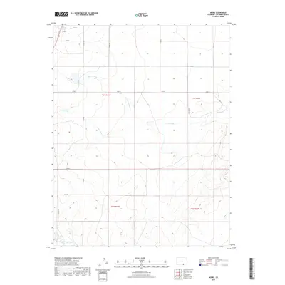
2019 Map of Model
USGS Topo · Published 2019About this map
Model sits in the high plains of Las Animas County, defined by a sparse network of county roads and seasonal watercourses. The landscape is carved by significant drainage features such as Blackwell Arroyo and Luning Arroyo, which trend toward the Purgatoire River in the southwestern portion of the map. This 2019 survey illustrates the enduring grid of the Public Land Survey System, with township boundaries like t31s r61w and t32s r60w organizing the terrain. The road network, including Co Rd 101 and Co Rd 52, provides the primary infrastructure for this ranching and agricultural region, where the vastness of the topography is punctuated only by these named arroyos and the settlement at Model.
Find a feature on this map
22 named features on this map. Tap any name to fly to it.
Don’t see what you’re looking for? This feature index may not catch every label — zoom into the map to look around manually.
Map Details
Editions of this 2019 Model Map
This is the sole edition of this map. No revisions or reprints were ever made.
Other maps of this area

1892 · Elmoro
USGS Topo · 1:125,000

1893 · Elmoro
USGS Topo · 1:125,000

1897 · Elmoro
USGS Topo · 1:125,000

1954 · Trinidad
USGS Topo · 1:250,000

1955 · Trinidad
USGS Topo · 1:250,000

1958 · Trinidad
USGS Topo · 1:250,000

1959 · Trinidad
USGS Topo · 1:250,000
1970 · Earl
USGS Topo · 1:24,000
1970 · Mooney Hills
USGS Topo · 1:24,000
1971 · Tyrone
USGS Topo · 1:24,000