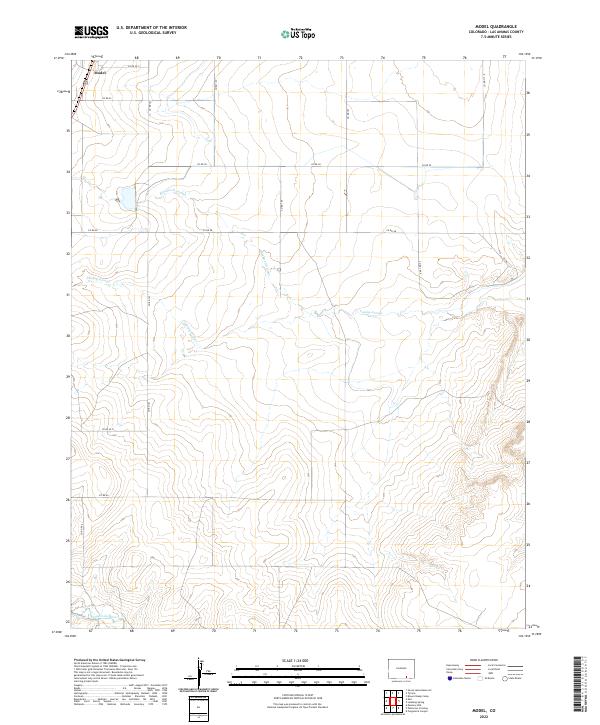
2022 Map of Model
USGS Topo · Published 2022About this map
Model sits in the northwest corner of this high-plains landscape, where the drainage patterns of the Purgatoire River define the southern reaches of the quadrangle. The terrain is characterized by a series of significant drainage channels, including Blackwell Arroyo and Luning Arroyo, which cut across the prairie surface between expansive sections of public and private land. A grid-like network of rural routes such as Co Rd 101 and Co Rd 50 provides the primary infrastructure for the area, connecting isolated ranching operations to the settlement at Model. The map illustrates the transition from the relatively flat arroyo-drained uplands in the north to the more complex, descending topography near the river canyon in the south, reflecting the traditional livestock and agricultural focus of Las Animas County.
Find a feature on this map
22 named features on this map. Tap any name to fly to it.
Don’t see what you’re looking for? This feature index may not catch every label — zoom into the map to look around manually.
Map Details
Editions of this 2022 Model Map
This is the sole edition of this map. No revisions or reprints were ever made.
Other maps of this area

1892 · Elmoro
USGS Topo · 1:125,000

1893 · Elmoro
USGS Topo · 1:125,000

1897 · Elmoro
USGS Topo · 1:125,000

1954 · Trinidad
USGS Topo · 1:250,000

1955 · Trinidad
USGS Topo · 1:250,000

1958 · Trinidad
USGS Topo · 1:250,000

1959 · Trinidad
USGS Topo · 1:250,000
1970 · Earl
USGS Topo · 1:24,000
1970 · Mooney Hills
USGS Topo · 1:24,000
1971 · Tyrone
USGS Topo · 1:24,000