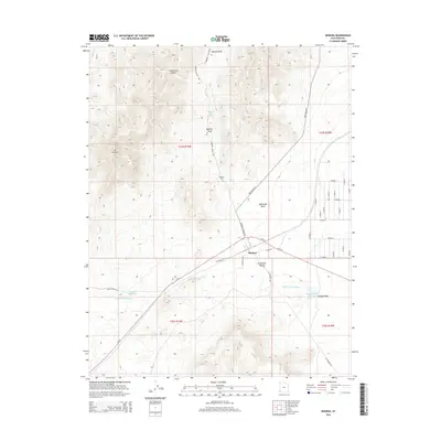
2014 Map of Modena
USGS Topo · Published 2014About this map
Modena sits as a critical junction in the arid landscape of Iron County, where the iron-rich topography meets the wide expanse of the Escalante Desert. This 2014 survey reveals a community shaped by water management in a high-desert environment, with infrastructure including the Modena City Reservoir, Modena Reservoir, and Modena Draw Reservoir positioned to catch seasonal runoff from the surrounding hills. The terrain is defined by dramatic elevation shifts, anchored by Mt Elenore to the west and a series of rugged drainages like Elderberry Canyon and Modena Draw. For those looking into local history, the Modena Cem and the natural Desert Spring offer tangible links to the settlement's footprint, while the intersection of Ut-56 and roads like Modena Canyon Rd indicate the area's continued role as a regional transport corridor.
Find a feature on this map
39 named features on this map. Tap any name to fly to it.
Don’t see what you’re looking for? This feature index may not catch every label — zoom into the map to look around manually.
Map Details
Editions of this 2014 Modena Map
This is the sole edition of this map. No revisions or reprints were ever made.
Other maps of this area

1885 · St. George
USGS Topo · 1:250,000

1885 · Pioche
USGS Topo · 1:250,000

1886 · Pioche
USGS Topo · 1:250,000

1891 · St. George
USGS Topo · 1:250,000

1953 · Cedar City
USGS Topo · 1:250,000

1954 · Caliente
USGS Topo · 1:250,000

1958 · Cedar City
USGS Topo · 1:250,000

1959 · Caliente
USGS Topo · 1:250,000

1962 · Cedar City
USGS Topo · 1:250,000
1972 · Uvada
USGS Topo · 1:24,000