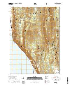
2020 Map of Modoc Point
USGS Topo · Published 2020About this map
Upper Klamath Lake defines the western edge of this landscape, where the waters meet the steep rise of Modoc Point. This area within the Winema National Forest is characterized by a series of high-elevation flats and ridges, including Chiloquin Ridge and Telephone Flat, which overlook the lake basin. The geography is marked by numerous water sources that emerge from the slopes, such as Barkley Spring, Ouxy Spring, and Shell Rock Spring.
Find a feature on this map
34 named features on this map. Tap any name to fly to it.
Don’t see what you’re looking for? This feature index may not catch every label — zoom into the map to look around manually.
Map Details
Editions of this 2020 Modoc Point Map
This is the sole edition of this map. No revisions or reprints were ever made.
Other maps of this area

1889 · Klamath
USGS Topo · 1:250,000

1894 · Klamath
USGS Topo · 1:250,000

1955 · Klamath Falls
USGS Topo · 1:250,000

1956 · Calimus Butte
USGS Topo · 1:62,500

1957 · Chiloquin
USGS Topo · 1:62,500

1957 · Swan Lake
USGS Topo · 1:62,500

1957 · Modoc Point
USGS Topo · 1:62,500

1958 · Klamath Falls
USGS Topo · 1:250,000

1980 · Williamson River
USGS Topo · 1:100,000
1985 · Shoalwater Bay
USGS Topo · 1:24,000