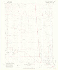
1968 Map of Moffat North
USGS Topo · Published 1970About this map
The high desert floor of the San Luis Valley is defined by a sparse but essential network of water management in this 1968 study. The settlement of Moffat sits in the southeastern corner, serving as a focal point for the surrounding flatlands. To the north, Mirage appears along the primary roadway, while the landscape is punctuated by numerous Flowing Wells and individual Flowing Well sites, indicating the critical role of artesian water for life and ranching in this arid Colorado basin.
Find a feature on this map
10 named features on this map. Tap any name to fly to it.
Don’t see what you’re looking for? This feature index may not catch every label — zoom into the map to look around manually.
Map Details
Editions of this 1968 Moffat North Map
2 editions found
Other maps of this area

1915 · Del Norte
USGS Topo · 1:125,000

1917 · Del Norte
USGS Topo · 1:125,000

1945 · Durango
USGS Topo · 1:250,000

1950 · Valley View Hot Springs
USGS Topo · 1:24,000

1953 · Durango
USGS Topo · 1:250,000

1954 · Durango
USGS Topo · 1:250,000

1954 · Trinidad
USGS Topo · 1:250,000

1954 · Pueblo
USGS Topo · 1:250,000

1955 · Trinidad
USGS Topo · 1:250,000

1956 · Montrose
USGS Topo · 1:250,000