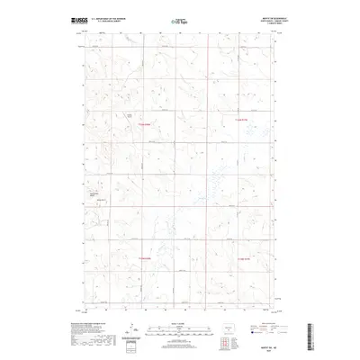
2020 Map of Moffit SW
USGS Topo · Published 2020About this map
Snyders Airport sits at the center of this rural prairie landscape in Emmons County, marking a localized node of activity amidst the vast sectioned fields of North Dakota. The terrain is defined by the winding paths of Glencoe Cr in the north and the multi-branched Badger Cr flowing through the southern reaches. In the southwestern corner, the topography becomes more distinct near Rattlesnake Butte and the neighboring Devils Gulch, providing a break from the surrounding plateau. The map details a strictly regulated grid of section lines and gravel roads, including 55th St SW and 2nd Ave SW, which reflect the enduring influence of the Public Land Survey System on the state's agricultural organization.
Find a feature on this map
26 named features on this map. Tap any name to fly to it.
Don’t see what you’re looking for? This feature index may not catch every label — zoom into the map to look around manually.
Map Details
Editions of this 2020 Moffit SW Map
This is the sole edition of this map. No revisions or reprints were ever made.
Other maps of this area

1907 · Bismarck
USGS Topo · 1:125,000

1954 · Bismarck
USGS Topo · 1:250,000

1958 · Bismarck
USGS Topo · 1:250,000

1968 · Cannon Ball
USGS Topo · 1:24,000

1971 · Moffit SW
USGS Topo · 1:24,000

1971 · Hazelton
USGS Topo · 1:24,000

1971 · Moffit SE
USGS Topo · 1:24,000

1971 · Fort Rice
USGS Topo · 1:24,000

1971 · Huff NE
USGS Topo · 1:24,000

1971 · Moffit NW
USGS Topo · 1:24,000