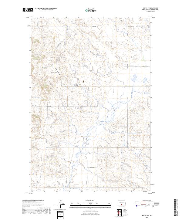
2024 Map of Moffit SW
USGS Topo · Published 2024About this map
Rattlesnake Butte and the winding course of Devils Gulch dominate the southwestern corner of this landscape, where the prairie topography of Emmons County is deeply etched by intermittent drainage systems. The map captures a largely rural expanse defined by a geometric grid of section lines and gravel roads, such as 58th St SW and 2nd Ave SW. Significant water features include the headwaters of Glencoe Creek and the meandering Badger Creek, which bisects the southern townships. A notable point of human activity in this sparsely populated region is Snyders Airport, located just north of the border between Township 136 North Range 78 West and Township 135 North Range 78 West. This survey highlights the intersection of modern aviation and traditional section-line agriculture in the North Dakota interior.
Find a feature on this map
25 named features on this map. Tap any name to fly to it.
Don’t see what you’re looking for? This feature index may not catch every label — zoom into the map to look around manually.
Map Details
Editions of this 2024 Moffit SW Map
This is the sole edition of this map. No revisions or reprints were ever made.
Other maps of this area

1907 · Bismarck
USGS Topo · 1:125,000

1954 · Bismarck
USGS Topo · 1:250,000

1958 · Bismarck
USGS Topo · 1:250,000

1968 · Cannon Ball
USGS Topo · 1:24,000

1971 · Moffit SW
USGS Topo · 1:24,000

1971 · Hazelton
USGS Topo · 1:24,000

1971 · Moffit SE
USGS Topo · 1:24,000

1971 · Fort Rice
USGS Topo · 1:24,000

1971 · Huff NE
USGS Topo · 1:24,000

1971 · Moffit NW
USGS Topo · 1:24,000