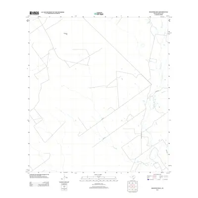
2013 Map of Mogotes Hill
USGS Topo · Published 2013About this map
Mogotes Hill stands as the primary topographic landmark in this section of Zapata County, overlooking a landscape defined by an intricate network of seasonal drainage and ranching infrastructure. The arid terrain is carved by several ephemeral watercourses, including Escobas Cr and Salómoneno Cr, which flow generally southeast toward larger basins. This 2013 survey illustrates the modern development of the South Texas brush country, where access is provided by family-named routes like Jennings Ranch Rd and Tanque Rd. The map also documents several unnamed paths, such as Un Rd 19 and Un Rd 20, reflecting the functional grid of private ranch lands and resource access roads that characterize this sparsely populated region of the Rio Grande Valley hinterlands.
Find a feature on this map
10 named features on this map. Tap any name to fly to it.
Don’t see what you’re looking for? This feature index may not catch every label — zoom into the map to look around manually.
Map Details
Editions of this 2013 Mogotes Hill Map
This is the sole edition of this map. No revisions or reprints were ever made.
Other maps of this area

1940 · Mogotes Hill
USGS Topo · 1:62,500

1942 · San Ygnacio
USGS Topo · 1:62,500

1949 · Mc Allen
USGS Topo · 1:250,000

1954 · McAllen
USGS Topo · 1:250,000

1956 · Mogotes Hill
USGS Topo · 1:62,500

1956 · Zapata
USGS Topo · 1:62,500

1956 · Arroyo Clareno
USGS Topo · 1:62,500

1956 · Laredo
USGS Topo · 1:250,000

1957 · Mc Allen
USGS Topo · 1:250,000

1962 · McAllen
USGS Topo · 1:250,000