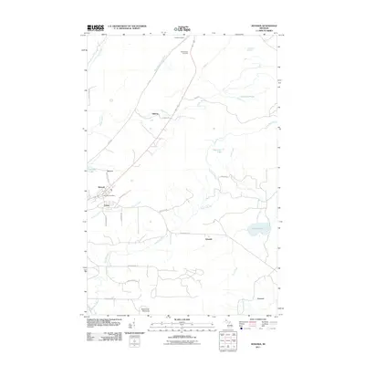
2011 Map of Mohawk
USGS Topo · Published 2011About this map
Mohawk and Fulton serve as the primary hubs in this section of the Keweenaw Peninsula, where the legacy of copper country settlement is etched into the landscape. The Mohawk Post Office anchors the townsite, while local history is documented at Hillside Cemetery and Cliff Catholic Cemetery to the north. The terrain is defined by a complex network of waterways, including the winding Trap Rock River and the West Branch Eagle River, which feed into numerous small lakes and ponds like Thayer Lake and Horseshoe Pond. A series of rural roads, such as Jack Kivela Rd and Mohawk Gay Rd, connect smaller clusters of activity at Ojibway, Seneca, and Hebards, reflecting a post-industrial landscape where residential footprints remain concentrated near former mining and timber interests.
Find a feature on this map
36 named features on this map. Tap any name to fly to it.
Don’t see what you’re looking for? This feature index may not catch every label — zoom into the map to look around manually.
Map Details
Editions of this 2011 Mohawk Map
This is the sole edition of this map. No revisions or reprints were ever made.
Other maps of this area

1938 · Bruneau Creek
USGS Topo · 1:31,680

1938 · Gay
USGS Topo · 1:31,680

1940 · Central
USGS Topo · 1:31,680

1941 · Ahmeek
USGS Topo · 1:31,680

1941 · Mohawk
USGS Topo · 1:31,680

1946 · Phoenix
USGS Topo · 1:24,000

1946 · Bruneau Creek
USGS Topo · 1:24,000

1946 · Mohawk
USGS Topo · 1:24,000

1946 · Eagle Harbor
USGS Topo · 1:24,000

1946 · Ahmeek
USGS Topo · 1:24,000